Visiting Prairie
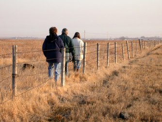
In eastern Grand Forks County, a belt of grassland 2-5 miles wide extends from ND Hwy15 northward to the border with Walsh County, a distance of more than 30 miles. Some is native prairie, but much is former cropland returned to grass under the Conservation Reserve Program. About 10,000
acres are managed by agencies such as U.S. Fish and Wildlife Service, North Dakota Game and Fish, North Dakota State Land Department, Water Board of Grand Forks County, and the University of North Dakota. Several thousand acres of native prairie are privately owned with some tracts being in the same family for five generations. A good place to start exploration of the grasslands is Kellys Slough National Wildlife Refuge. Go west of I-29 on U.S. 2 for 7.7 miles (watch for sign) and then drive 3 miles north. Another prime area is the Prairie-Chicken Management Area, which begins 1.5 miles north of Mekinock on County Road 3. The University of North Dakota owns about 1000 acres that can be viewed by going east from Emerado on County Road 4 for two miles, and then turning south on 21st St N.E. The University land is on the left as you drive the next two miles. Much can be appreciated by driving the quieter roads and stopping often to look and listen. Watch for signs that mark the corners of a Waterfowl Production Area or Wildlife Management Area. Such lands can be visited on foot. Always ask permission before entering private lands. A map of the entire grassland area with suggested stops to see birds is incorporated in "Prairie Birding Routes", available from Grand Forks County Prairie Partners.
acres are managed by agencies such as U.S. Fish and Wildlife Service, North Dakota Game and Fish, North Dakota State Land Department, Water Board of Grand Forks County, and the University of North Dakota. Several thousand acres of native prairie are privately owned with some tracts being in the same family for five generations. A good place to start exploration of the grasslands is Kellys Slough National Wildlife Refuge. Go west of I-29 on U.S. 2 for 7.7 miles (watch for sign) and then drive 3 miles north. Another prime area is the Prairie-Chicken Management Area, which begins 1.5 miles north of Mekinock on County Road 3. The University of North Dakota owns about 1000 acres that can be viewed by going east from Emerado on County Road 4 for two miles, and then turning south on 21st St N.E. The University land is on the left as you drive the next two miles. Much can be appreciated by driving the quieter roads and stopping often to look and listen. Watch for signs that mark the corners of a Waterfowl Production Area or Wildlife Management Area. Such lands can be visited on foot. Always ask permission before entering private lands. A map of the entire grassland area with suggested stops to see birds is incorporated in "Prairie Birding Routes", available from Grand Forks County Prairie Partners.
Home | Partners | Field Guide | Heroes | Gallery | Links | Contact Us
Grand Forks County Prairie Partners - 2011 - All Rights Reserved
